
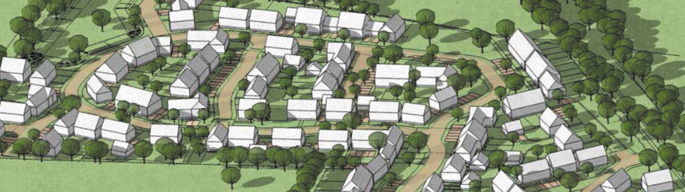
Open Spaces & Landscaping
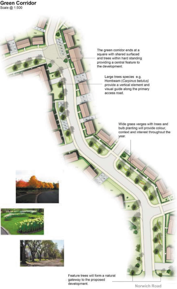
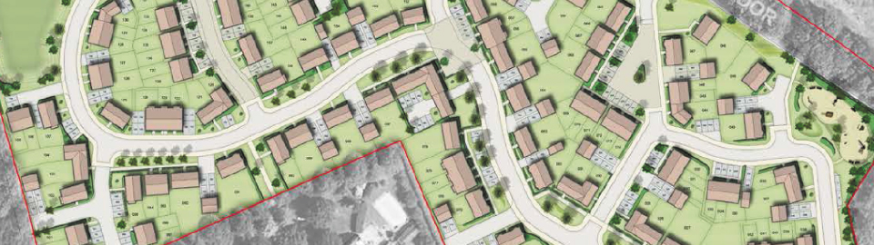
The proposed green space within the development is predominately located along the southern and north-eastern site boundaries. This will provide ample space for recreational purposes and provide habitats for wildlife and increased biodiversity. The existing trees are situated along the north and west boundaries of the site. The site is bounded on each side by existing hedgerow. The trees and hedgerow will be retained where possible. Creating a strong street frontage along the public open space is important as this will create a sense of place as well as address the existing road and housing. The former railway line running along eastern boundary of site allows for enhanced ecological trail. A Village Green is proposed towards the north of the site allowing the proposal to make the most of the existing ecological trail adjacent to the site and is easily accessed by local footways. Green areas will run along the main spine road which will reflect the rural character of Swaffham within the proposed development. A play area is proposed to the north east of the site which will be connected to the surrounding area via a footpath.
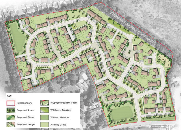
Proposed Landscape Masterplan
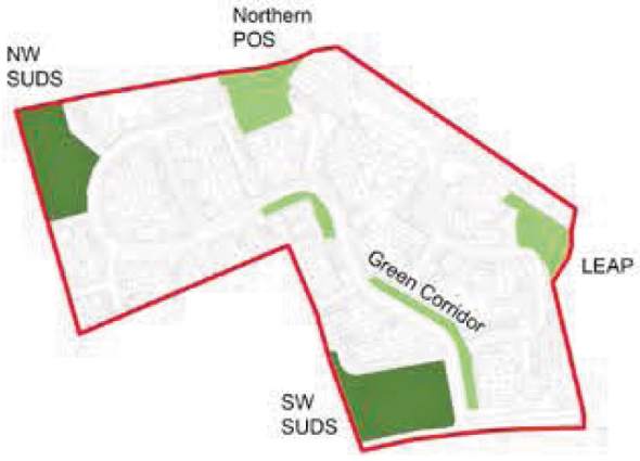
Public open space and SUDS location in relationship to the overall development area (not to scale).
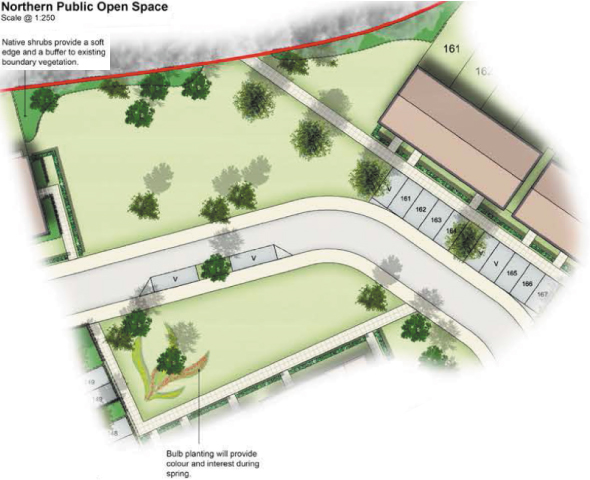
1. Northern Public Open Space.
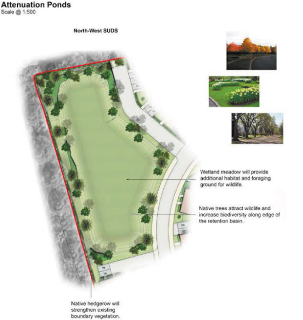
2. The Attenuation Ponds - North-west SUDS.
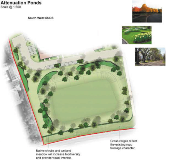
3. The Attenuation Ponds - South-west SUDS.
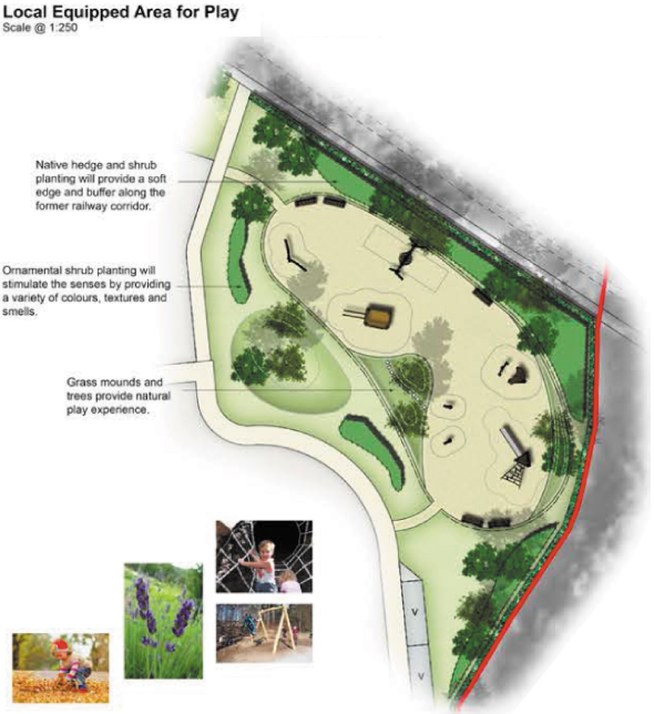
3. The Play Area with typical play equipment.